Notice
Dr Tomasz Panecki - Digital editions of historical maps: between images and data. The example of “Gaul/Raczyński” topographic map (1807-1812)
- document 1 document 2 document 3
- niveau 1 niveau 2 niveau 3
Descriptif
Dr Tomasz PANECKI
Institute of History, Polish Academy of Sciences - PL
Tomasz Panecki, PhD – assistant professor at the Department of Historical Atlas (Institute of History, Polish Academy of Sciences). Obtained master degree in history and geography and defended doctoral thesis at the Faculty of Geography and Regional Studies (University of Warsaw) entitled “The Concept of Historical Topographic Objects' Database”. Scientific interests include: old maps digital editions & historical mapping including history of cartography, spatiotemporal ontologies and databases, conceptualization of place and its categories in diachronic context, cartographic representation of real world entities.
Dans la même collection
-
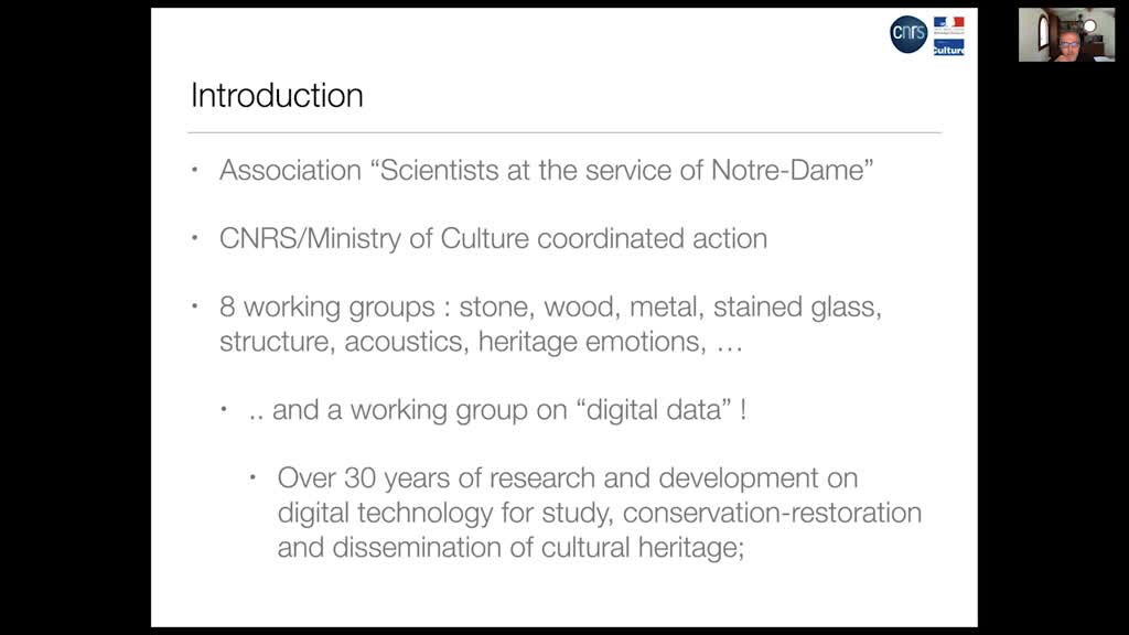
Dr Livio De Luca - A digital ecosystem to document, in space and time, the restoration of Notre-Dam…
De LucaLivioDr Livio DE LUCA Models and Simulations for Architecture and Heritage / CNRS - FR Architect, PhD in Engineering (Arts et Métiers ParisTech), HDR in Computer Science, Livio De Luca is research director
-
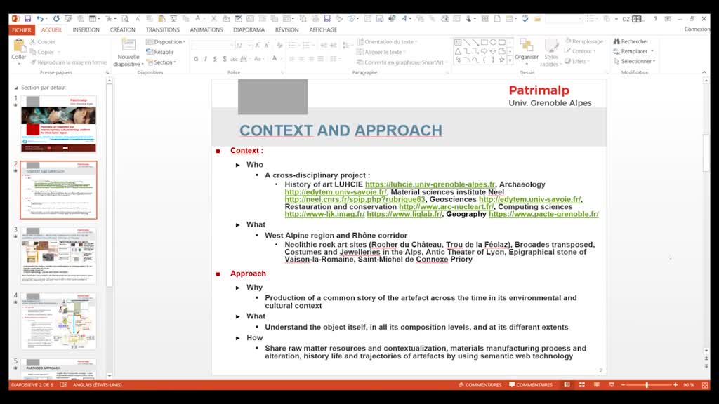
Prof. Danielle Ziébelin - Patrimalp, an integrated and interdisciplinary cultural heritage platform…
ZiébelinDanielleProf. Danielle ZIÉBELIN Department of Computer Science, Grenoble Alpes University – FR Co-authors: Matthew Sreeves, Fatima Danash, Karine Aubry, Emilie Chalmin Danielle Ziébelin is a Professor at the
-
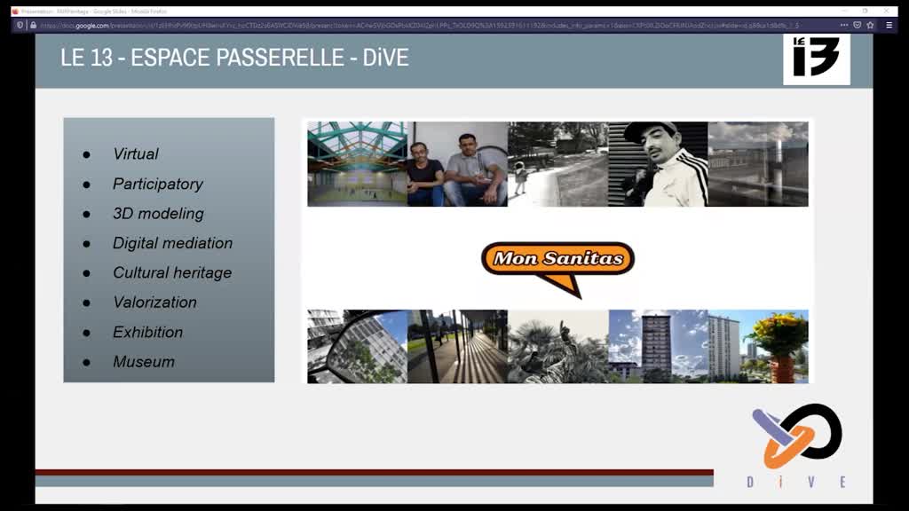
Mériç Akdogan, Pauline Bellemere et Inoussa Kora Chabi - DiVE Project
AkdoganMériçBellemerePaulineKORA CHABIInoussaFlash talk
-
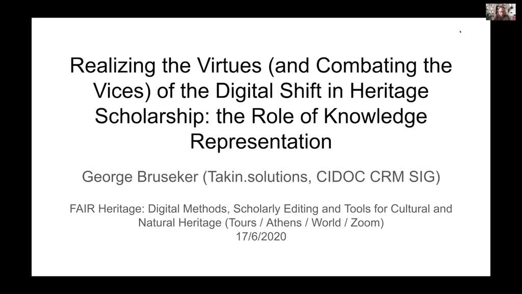
Dr George Bruseker - Realizing the Virtues (and Combating the Vices) of the Digital Shift in Herita…
BrusekerGeorgeGeorge Bruseker is Vice Chair of the CIDOC CRM Special Interest Group and an expert in the field of knowledge representation and semantics for cultural heritage. He has a PhD in Philosophy from the
-
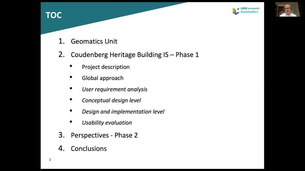
Prof. Roland Billen - The Coudenberg Heritage Building Information System
BillenRolandProf. Roland BILLEN Geomatics Unit, University of Liège - BL Roland Billen holds a PhD degree in Geomatics from the University of Liege. He was a research fellow of the Belgian National Scientific
-
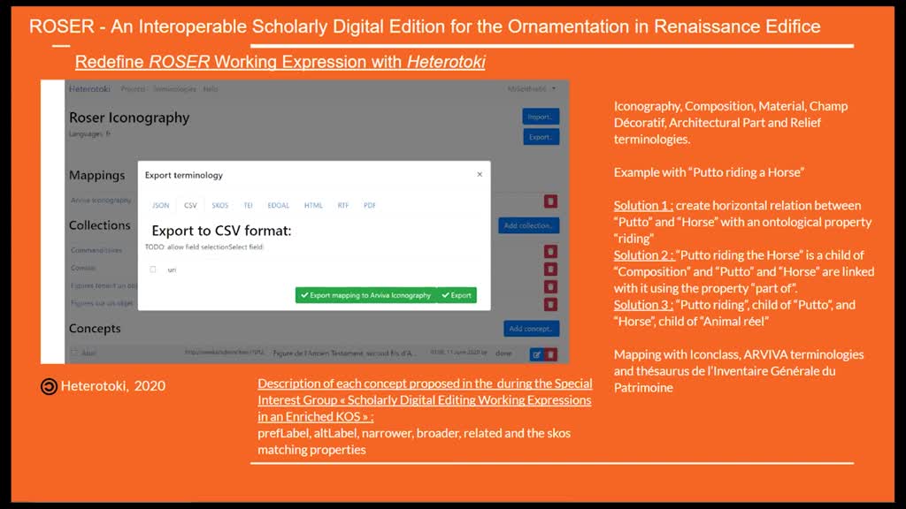
Florian Hivert - ROSER - Répertoire de l’Ornement Sculpté des Édifices de la Renaissance: An intero…
HivertFlorianFlorian HIVERT Center for Advanced Renaissance Studies (CESR) / CNRS, University of Tours - FR Student in the M.A program Intelligence des données de la culture du patrimoine at the Centre d’Études
-
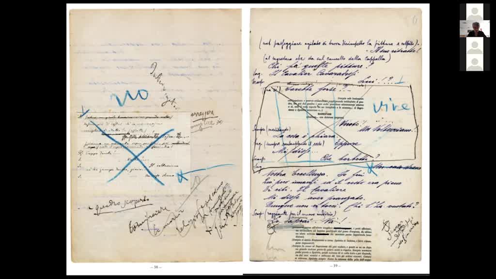
Prof. Elena Pierazzo - The edition of draft manuscripts: theories, (data) models and methods
PierazzoElenaProf. Elena PIERAZZO Center for Advanced Renaissance Studies (CESR) / CNRS, University of Tours – FR Elena Pierazzo is Professor of Digital Humanities at Centre d’Études Superieures de la Renaissance,
-
Prof. Douglas Tudhope - Reflections on the semantic integration of archaeological datasets and grey…
TudhopeDouglasProf. Douglas TUDHOPE University of South Wales - UK Co-author: Ceri BINDING AHRC funded STAR, STELLAR and SENESCHAL projects (Semantic Tools for Archaeological Resources), in collaboration with
-
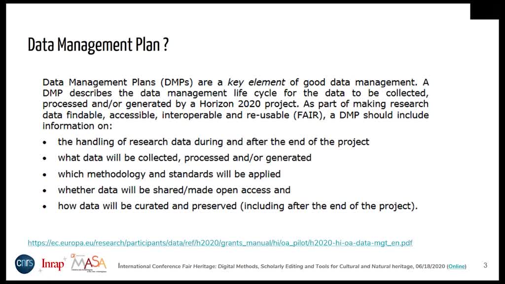
Nathalie Le Tellier-Becquart, Emmanuelle Bryas, Emmanuelle Morlock – DMP MASA
Le Tellier-BecquartNathalieBryasEmmanuelleMorlockEmmanuelleNathalie Le Tellier-Becquart, MSH Mondes - FR Emmanuelle Bryas, French National Institute for Preventive Archaeological Research - FR Emmanuelle Morlock, HiSoMA - FR
-
-
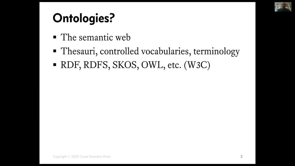
Dr Cesar Gonzalez-Perez - Ontologies of Cultural Heritage for Humans and Machines: The Cultural Her…
González PérezCésar A.Dr Cesar GONZALEZ-PEREZ Institute of Heritage Sciences, Spanish National Research Council (CSIC) - ES Cesar has degrees in Biology, Electronics, Computing, and Geography and History. Currently, he is
-
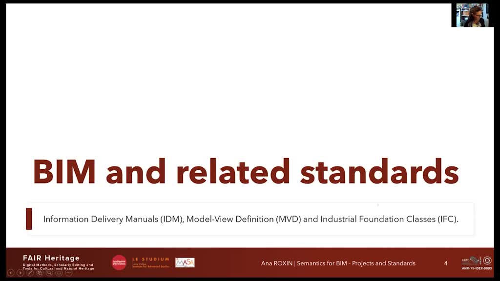
Prof. Ana Roxin - Semantic-based BIM Modelling : Approaches and related Standardization Actions
RoxinAnaDr Ana Roxin University of Burgundy (UBFC), Computer Science Laboratory of Burgundy (LIB) - FR Ana Roxin is Associate Professor in Computer Science, habilitated to conduct research, at the University