Notice
3 - "Cartographie de la vulnérabilité des territoires face aux feux de forêt : évaluation multicritères participative"
- document 1 document 2 document 3
- niveau 1 niveau 2 niveau 3
Descriptif
The Mediterranean region is routinely affected by forest fires, with adverse consequences on ecological, infrastructural, and socioeconomic assets. However, few studies tackle the issue of characterizing territorial vulnerability with respect to an increasing wildfire risk. We focus on Southern France and perform an assessment of fire risk and vulnerability using a spatial multicriteria decision analysis (MCDA) method where expert judgements are gathered through a participative approach. We apply a conceptualisation of risk and vulnerability from the hazards literature adapted to the case of forest disturbances, making a clear distinction between several subcomponents - hazard, exposure, sensitivity and adaptive capacity - which we assess for three categories of assets – people, infrastructure and ecosystems. We develop a series of spatialised indicators using ecological, land-use and sociodemographic data, which we aggregate using Saaty’s Analytical Hierarchy Process. Results show expert judgements on indicators’ relative importance to be highly consistent. They reveal significant differences in indicators’ perceived contribution to risk and vulnerability and enable appraising the contribution of sociodemographic factors, often overlooked in the literature. Map results reveal differences in spatial patterns across both vulnerability subcomponents and exposed assets. They help identify primary and secondary vulnerability hotspots, and comparisons with individual indicator maps help understand how underlying determinants affect vulnerability and risk. Confrontation with a hazard map obtained with a wildfire simulation model highlights both discrepancies and commonalities in spatial patterns for vulnerability and hazard. Consideration of multiple subcomponents of risk and vulnerability may help local decision makers prioritize how and where measures should be implemented, while the use of MCDA favours experience and knowledge sharing and among stakeholders while providing a basis of discussion
Dans la même collection
-
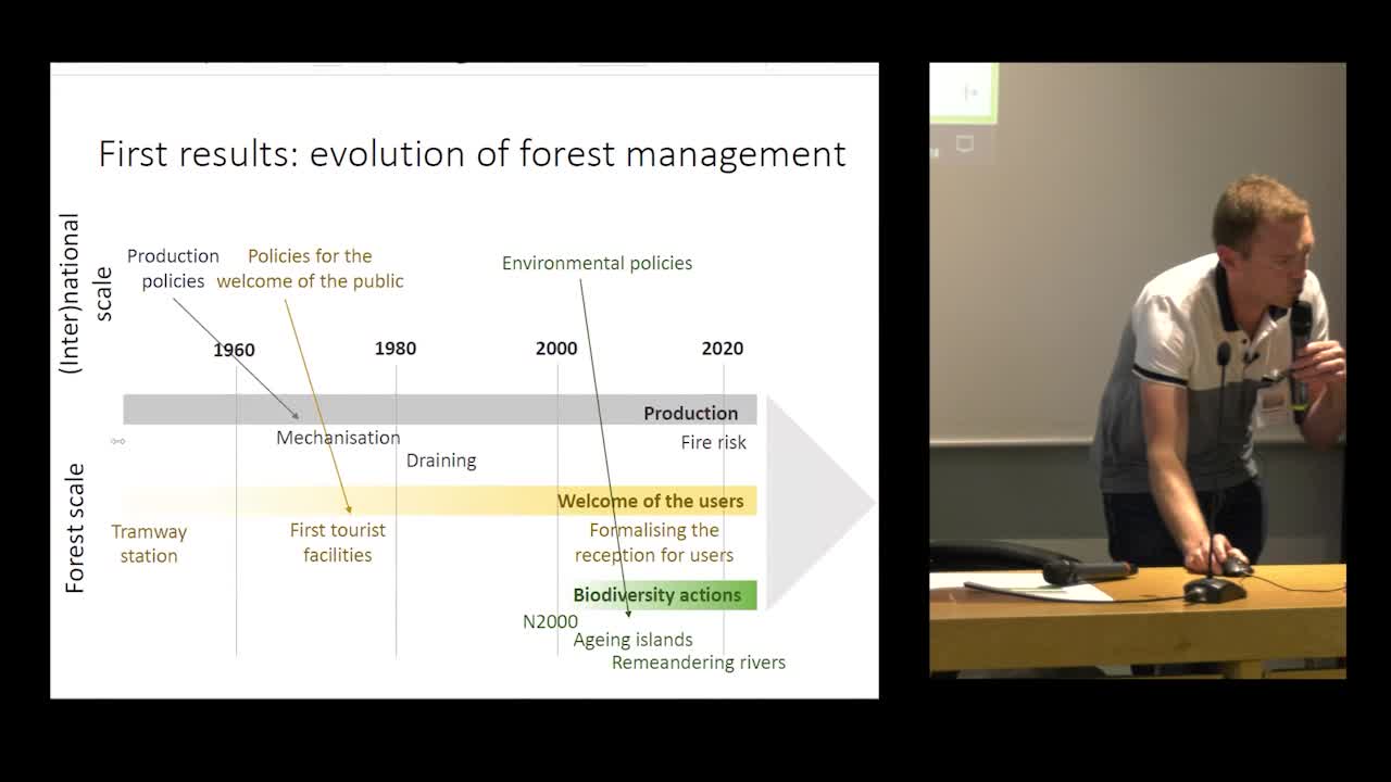
8 - "Les (nouveaux) communs forestiers dans la fabrique des transitions territoriales"
LengletJonathanDepuis récemment, les (biens) communs forestiers suscitent un intérêt renouvelé dans les médias et les débats publics.
-
9 - "Recette franco-belgo-québécoise pour des adaptations sociales et économiques : un jeu sérieux,…
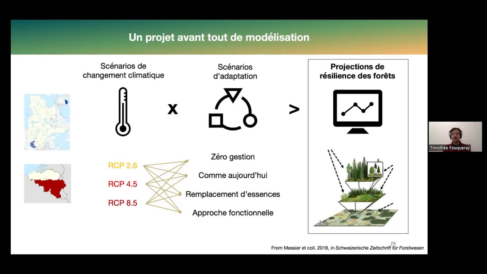
FouquerayTimothéeLa majorité des recherches et discours sur l’adaptation de la foresterie aux changements climatiques sont d’ordre technique : choix des essences, modes de régénération, de mélange ou non...
-
7 - "Dynamiques des bioraffineries forestières dans les Landes (France) et la Tuque (Québec) : Quel…
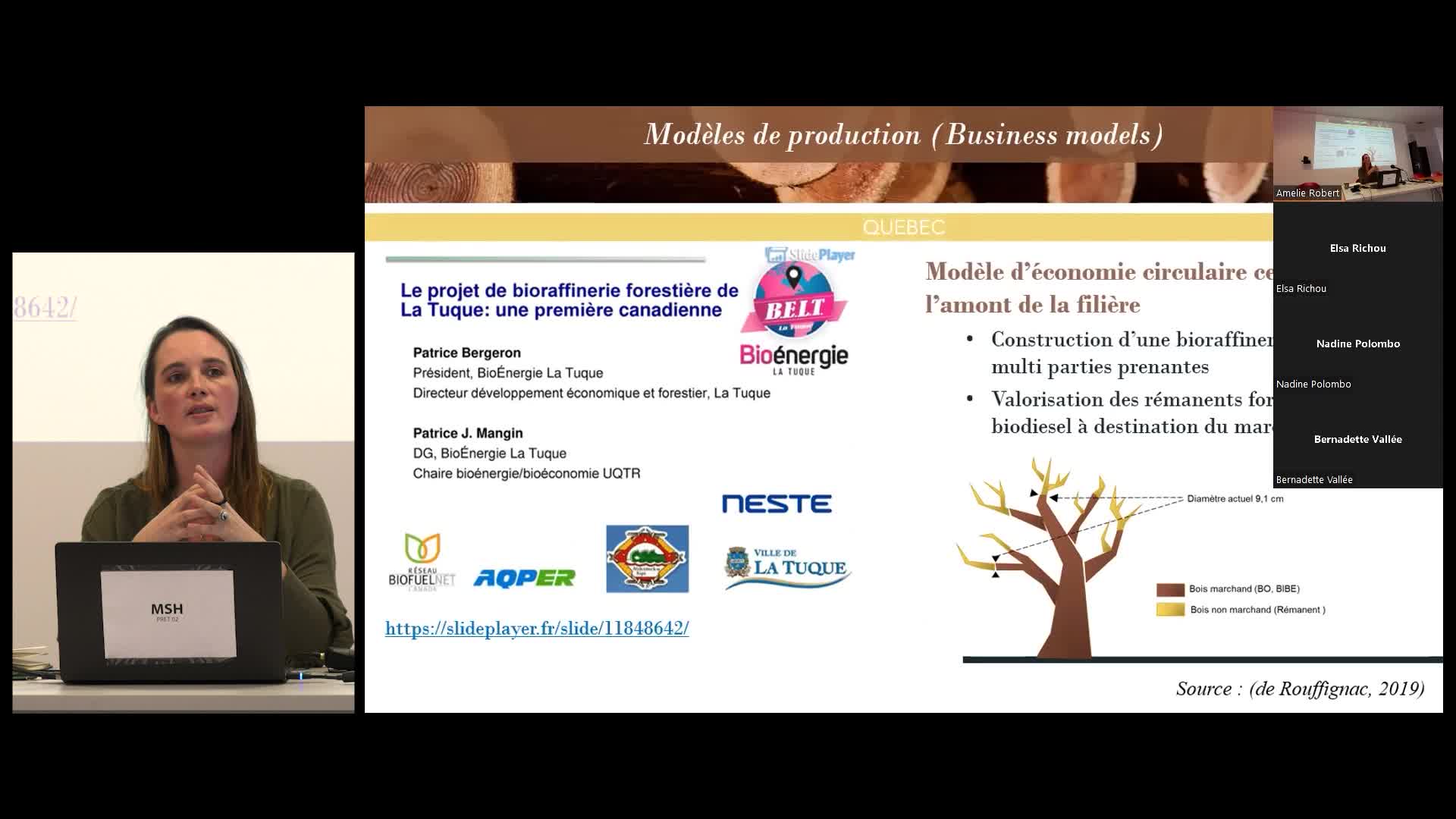
De rouffignacAliénorLa bioraffinerie apparaît de plus en plus comme support des espoirs d’opérationnalisation de la bioéconomie et de la transition écologique.
-
6 - "La filière bois française confrontée aux défis de l'écologisation. Nouveaux questionnements et…
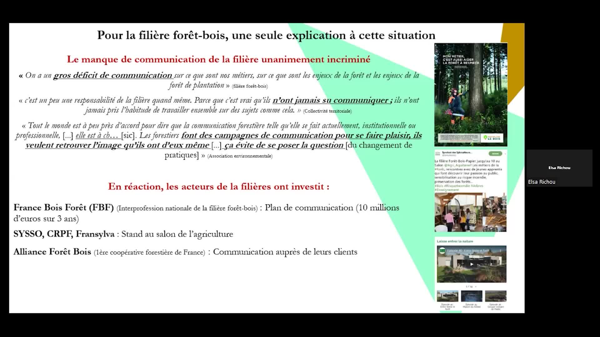
RichouElsaDe nos jours, la filière forêt-bois fait face à l’écologisation croissante des esprits à l’oeuvre dans la société française.
-
5 - "Les plantations forestières : une solution face aux changements globaux ?"
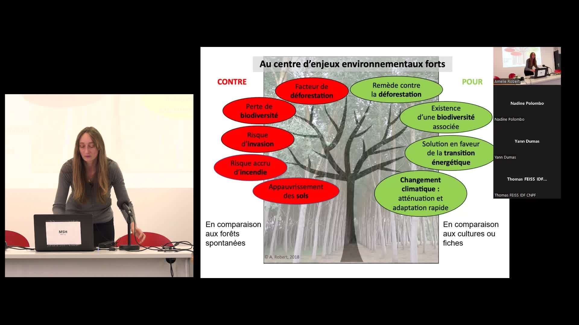
RobertAmélieLes plantations forestières sont aujourd’hui particulièrement encouragées, en tant que moyen d’atténuation du changement climatique, via la séquestration et le stockage du carbone qu’elles autorisen.
-
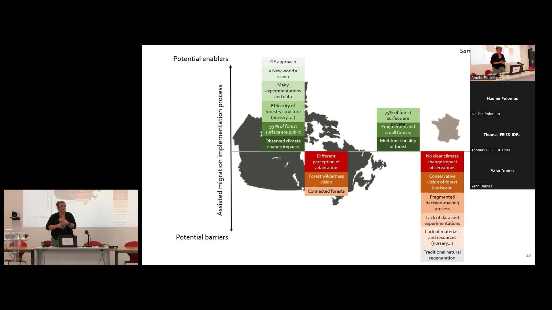
4 - "La migration assistée comme stratégie d'adaptation pour les forêts françaises : de la concepti…
SansilvestriRoxaneFace aux problématiques climatiques, la mise en place de stratégies d’adaptation apparaît comme un des grands challenges de nos sociétés actuelles, et la sphère de la foresterie ne fait pas exception.
-
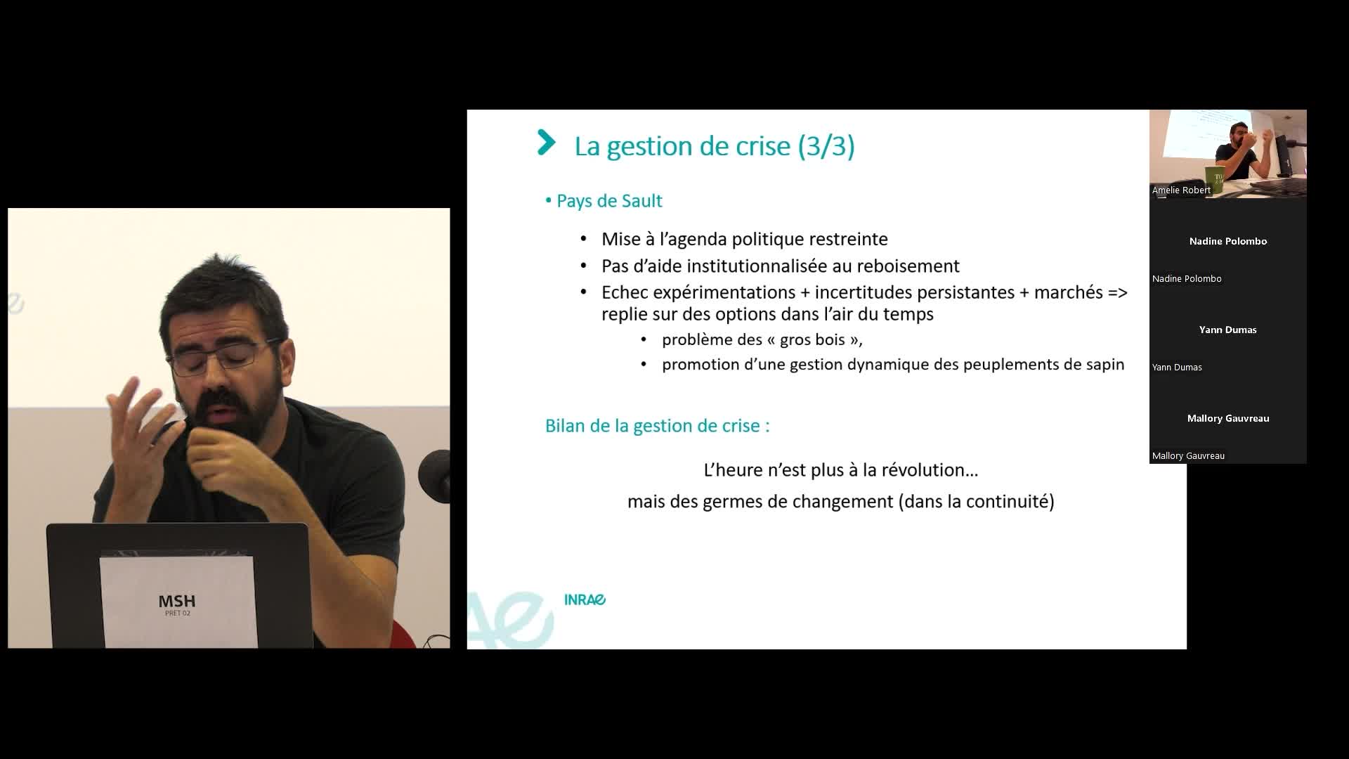
2 - "Après la catastrophe, bifurquer ou persévérer ? Retour sur les stratégies d'adaptation des for…
BanosVincentDes tempêtes aux scolytes en passant par la sécheresse et les incendies, les forêts sont en première ligne face à la multiplication des évènements climatiques ou biotiques extrêmes.
-
Séminaire « La filière forêt-bois face aux changements globaux : quelles adaptations ?» (introduct…
RobertAmélieLe séminaire est organisé par l’équipe du projet Plantaclim (financé par la région Centre-Val de Loire), avec le soutien de l’UMR CITERES, du réseau thématique de recherche Milieux et Diversité (MiDi)

Avec les mêmes intervenants et intervenantes
-
Modélisation prospective et action publique dans le secteur forêt-bois
RiviereMiguelSession plénière 2 : Privilégier les approches plurielles et intégrées. Transdisciplinarité et concertation/Favoring plural and integrated approaches. Transdisciplinarity and consultation
Sur le même thème
-
L’aménagement au cœur de la gestion durable des forêts
LegayMyriamMyriam Legay, directrice du campus AgroParisTech de Nancy, explique dans cette vidéo ce que signifie "gérer durablement" une forêt.
-
Qu’est-ce qu’une forêt ?
BlancLilianLilian Blanc, chercheur au CIRAD, donne dans cette vidéo un aperçu de la diversité des formations forestières dans le monde.
-
Enjeux et priorités pour la COP 30 Climat à Belem : apport de l'IRD - Cosavez-vous ? Climat Science…
La COSAV Climat Sciences Société organise ce séminaire pour explorer les enjeux cruciaux de la prochaine COP 30, qui se tiendra à Belém en novembre prochain, ainsi que les contributions des recherches
-
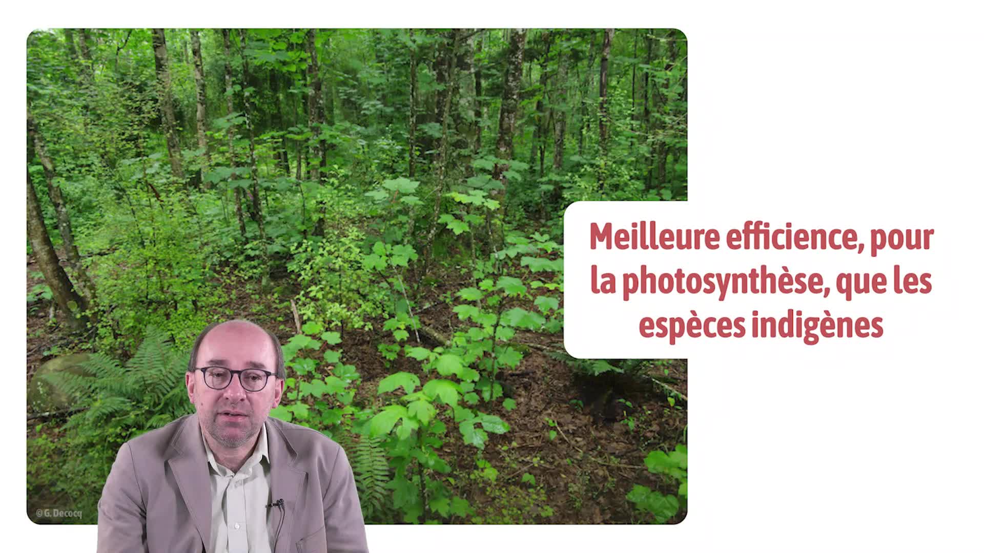
Les plantes exotiques envahissantes en forêt
DecocqGuillaumeGuillaume Decocq, professeur à l'université de Picardie Jules Verne, discute dans cette vidéo des invasions biologiques en milieu forestier.
-
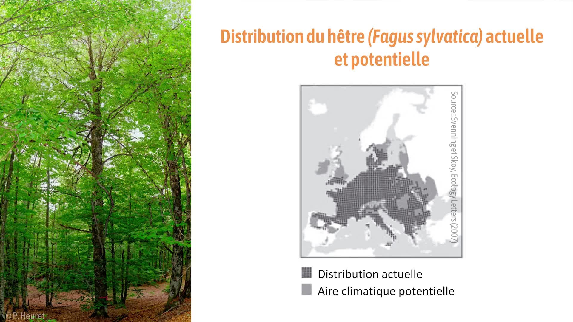
Quels facteurs expliquent les aires de distribution des arbres ?
DerroireGéraldineGéraldine Derroire, chercheuse au CIRAD, parle dans cette vidéo des limites à la présence des arbres.
-
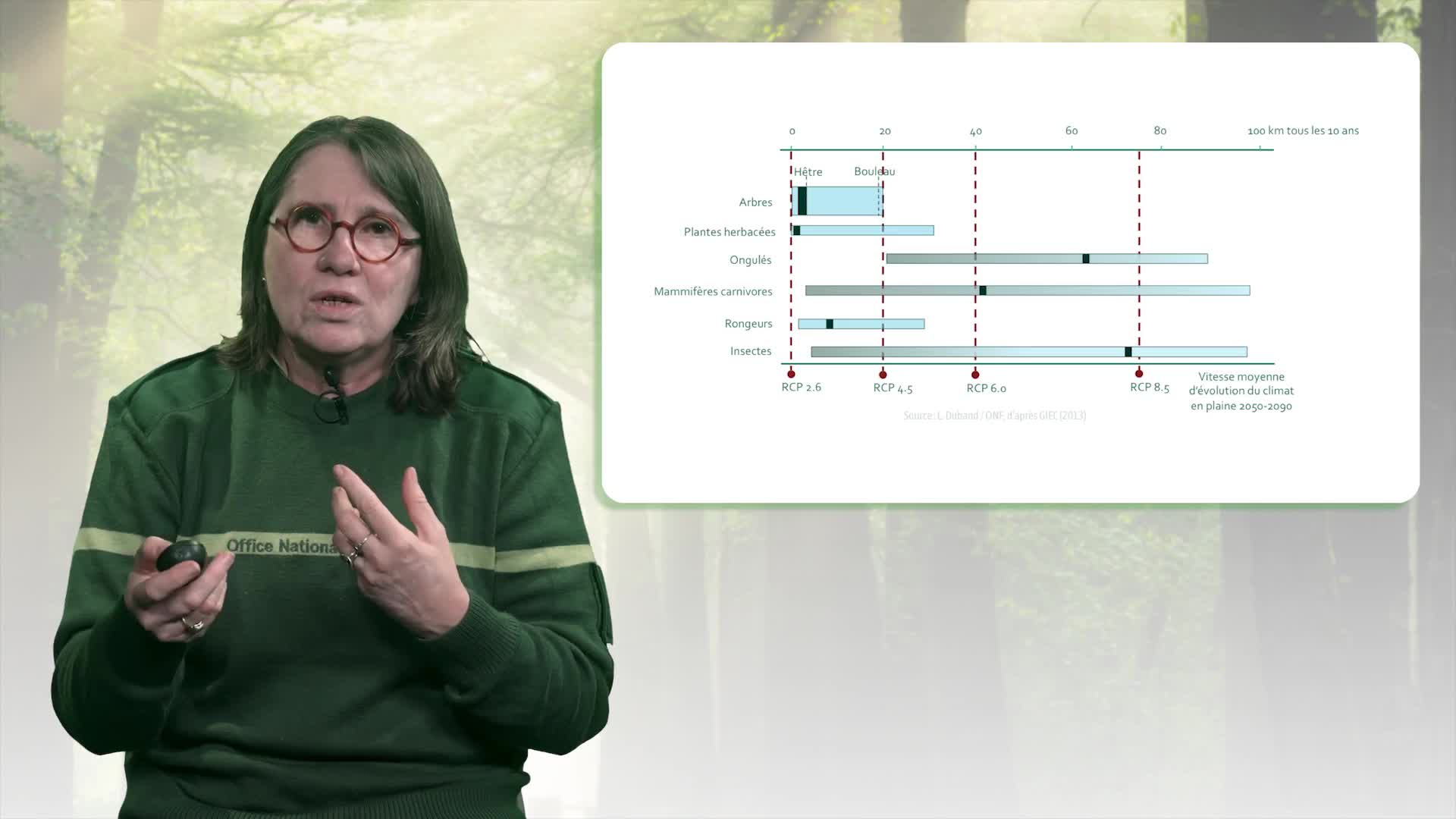
Comment adapter la forêt face au changement climatique ?
Musch-DemesureBrigitteBrigitte Musch, coordinatrice nationale des ressources génétiques forestières à l'ONF, discute dans cette vidéo de l'adaptation des forêts au changement climatique.
-
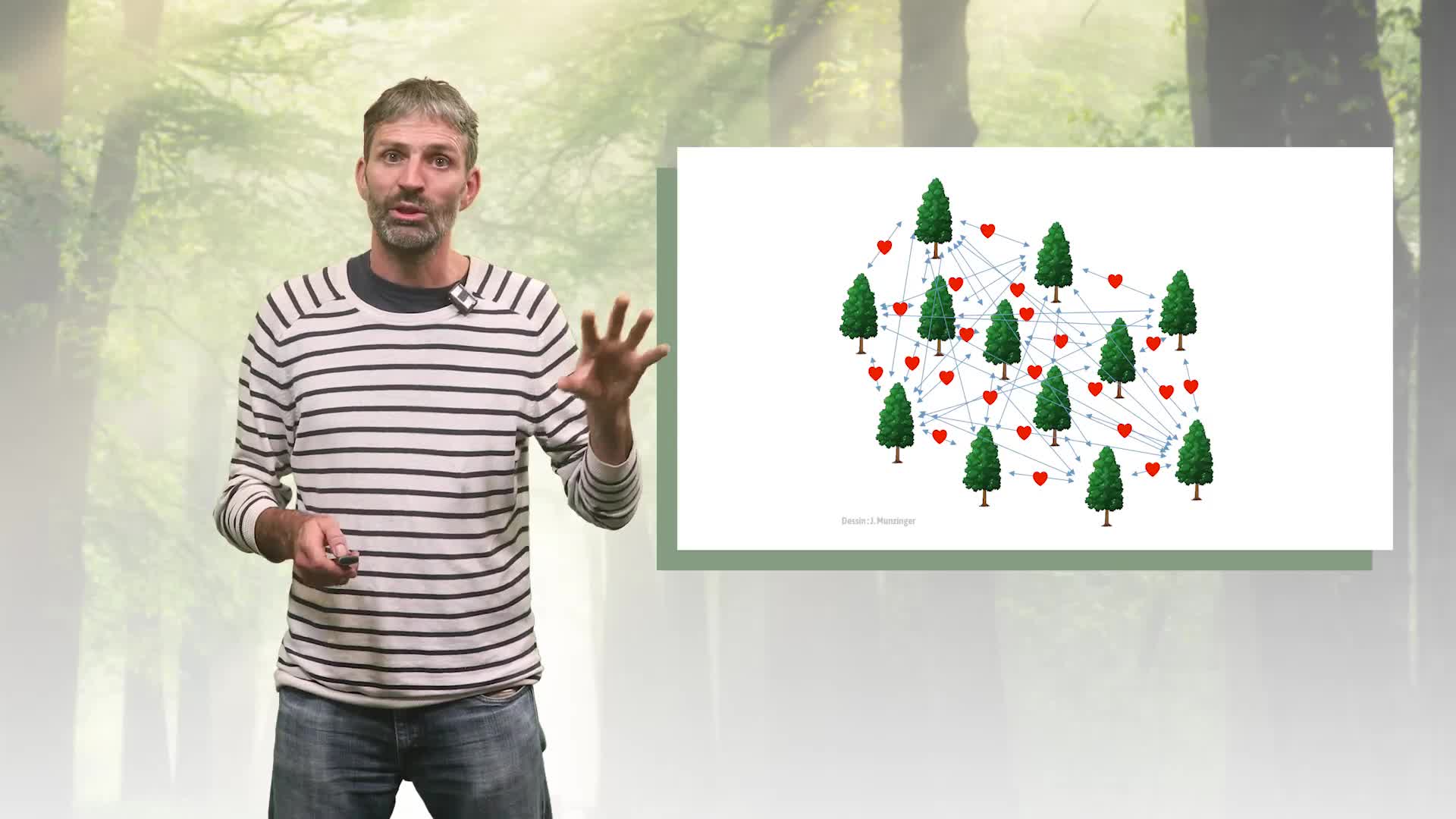
Combien d'arbres connus et à découvrir ?
MunzingerJérômeJérôme Munzinger, chercheur à l'IRD, parle dans cette vidéo de l'identification de nouvelles espèces d'arbres.
-
Le Laboratoire de paysage d’Alnarp (Suède) : une forêt expérimentale pour une appropriation vécue d…
SzántóCatherineConférence du 8 février
-
ANR X EHESS : Inégalités et vulnérabilités (2-1)
HuretRomainGiry-LozinguezClaireCourtetCatherineDubetFrançoisZevounouLionelKiesowRainer MariaA l’occasion de la sortie du Cahier de l’ANR consacré au bilan de près de deux décennies de recherche sur les inégalités et les vulnérabilités dans notre société...
-
Trajectoire socio-écosystémique de la Forêt de Rennes
BonthouxSébastienCholletSimonSession plénière 2 : Privilégier les approches plurielles et intégrées. Transdisciplinarité et concertation/Favoring plural and integrated approaches. Transdisciplinarity and consultation
-
Les visages de la vulnérabilité en droit
BioyXavierLa notion de vulnérabilité est souvent placée au cœur de la recherche sur l'éthique et les humanités en santé, mais il s’agit d’un élément théorique rarement approfondi. Elle est généralement
-
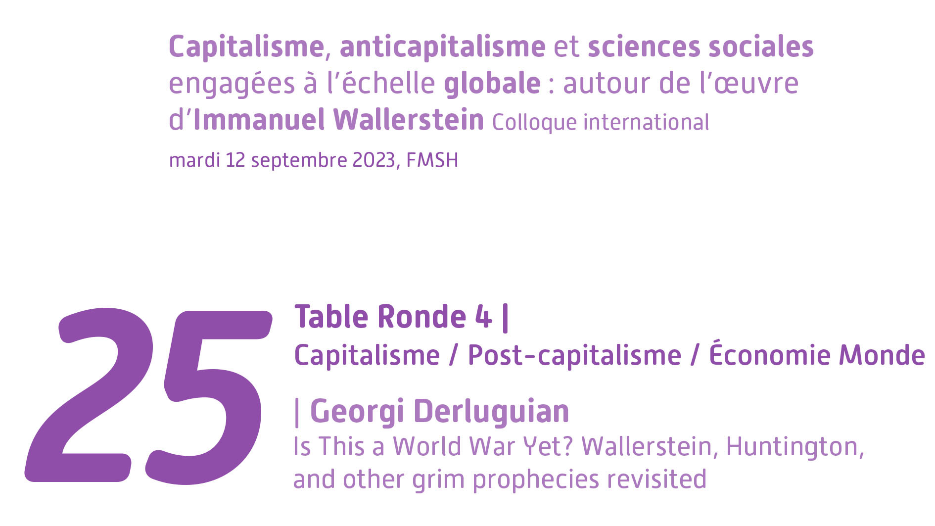
Table Ronde 4 | Is This a World War Yet? Wallerstein, Huntington, and other grim prophecies revisit…
DerluguianGeorgi M.Dans le cadre de ses 60 ans, la Fondation Maison des sciences de l'homme organise le colloque international "Capitalisme, anticapitalisme et sciences sociales engagées à l'échelle globale : autour de